|

|
Altimeter Digital GPS + Map Viewer + Cam 1.0
The most accurate and handly Altimeter is here. It gives you the altitude wherever you are.Simply start the app and altitude will appear in a second, No setup required. You can also adjust Altitude in Feet or Meter as per your requirement.
free download trial (716 Kb)
|
|

|
Eye4Gps GPS mapping software 3.0
GPS Mapping Software for Windows, Loading topographic maps, Realtime navigation and more. The software can be used with various map formats including: GeoTiff, OpenStreetMap XML, BSB Nautical Charts, AutoCad DXF files, ESRI Shapefiles and image files
free download trial (8.3 Mb)
|
|

|
Latitude Longitude 1.0
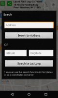
Latitude and Longitude app for android allows you to get or share map coordinates of your current location. share your current gps location with anyone using GPS coordinates, address or both.
free download (2.44 Mb)
|
|
|
|
|

|
VIGps 1.0
- you can show a currentl GPS data;
- you can open any of scanned maps;
- you can calibrate the scanned maps yourself by two calibration points only;
- calibrations are stored automatically for every map;
free download trial (4.56 Mb)
|
|

|
Eye4Software GPS Toolkit 2.4
Toolkit to add GPS functionality to software (GPS SDK). All NMEA0183 protocol versions are supported, Garmin USB PVT support. Support for datum conversions and coordinate conversion using different map projections.
free download trial (595 Kb)
|
|

|
Eye4Gps 2.1
GPS Mapping Software for Windows, Loading topographic maps, manage GPS devices and more. The software can be used with various map formats including: GeoTiff, BSB Nautical Charts, AutoCad DXF files, ESRI Shapefiles.
free download trial (19.03 Mb)
|
|
|
|
|

|
OpenOffice Calc Print Multiple Files Software 7.0
Print many OpenOffice Calc files without opening each one. Calc 2.0 or higher required.
free download trial (760 Kb)
|
|

|
OkMap 8.8.3
OkMap is a software that works with vectorial and raster maps that you have bought or scanned. OkMap lets you organize paths by creating waypoints, routes and tracks, and upload/download data to/from your GPS. OkMap supports GPS real-time navigation.
free download (20.21 Mb)
|
|

|
CopanMobile for PocketPC 1.0.2
CopanMobile for PocketPC allows you to COGO (coordinate geometry), process field surveys, adjust map traverses, perform map/deed checks, calc curves and areas/perimeters, transform coords, interface with GPS, and import/export Ascii files. It's free.
free download (341 Kb)
|
|

|
GOGO Exif Image Viewer ActiveX OCX 2.36
GOGO Exif Image Viewer ActiveX OCX helps you to get all embedded image information include EXIF, TIFF and GPS tags. It also allows you to write useful information back to Jpeg, Png and Tiff image. You can use it as a simply image viewer ActiveX.
free download trial (1.68 Mb)
:: order online ($59.90)
|
|
Pages : 1 | 2
| 3
| 4
| 5
|
|
|
|


