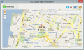
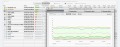
|
|
Graph Earth 0.9.5
Visualize your data in 3D! Quick, easy and inexpensive. Graph Earth enables business professionals to create stunning visual representations of their data, all without the time and costs associated with a full-feature GIS.
free download trial (469 Kb)
|
|
|
XML Vector Canada Map 1
XML Canada Map.
free download trial (4.88 Mb)
|
|
|
Web directory,search engine,submit url, 6.4
Google Toolbar,Google Browser,Web Browser,Google Web Browser,Toolbar,Download Google Toolbar,Free Download,web directory,search engine,submit url,
free download (1.56 Mb)
|
|
|
|
|
Submit site 1.02
submit site,Use this submit site to google add url for business search engines and website promotion directory module.
free download (6.77 Mb)
|
|
|
FSS Google Maps Downloader 1.0.2.2
FSS Google Maps Downloader is a tool that can download the Google Maps images to your PC. It can save them to your hard disk, including the normal maps and satellite maps. After downloading, you can view the maps offline by any image viewer.
free download (1.59 Mb)
|
|
|
Google Gmail Migration Tool 1.0
Google Gmail migration tool is the finest site available to migrate all your Gmail mails in different formats as per your need.
free download trial (24.7 Mb)
|
|
|
|
|
Migrate from Lotus Notes to Google Apps 5.0
Migrate data from Lotus Notes to Google Apps. Lotus notes to Google Apps Migration tool let you start with migrating Lotus Notes NSF database to Google Apps. Google Apps migration for Lotus Notes get easier and child play with this migration utility.
free download trial (16.4 Mb)
|
|
|
NetSpot 2.14.1037
NetSpot 2 is the only professional app for wireless site survey, Wi-Fi analysis and troubleshooting on Mac OS X. It's FREE and very simple, no need to be a network expert to start using NetSpot today!
free download (13.87 Mb)
|
|
|
Webdrive for MAC 3.31
An FTP Client for the Mac that connects to FTP, WebDAV and SFTP Servers as a mounted device.
free download trial (23.4 Mb)
|
|
|
Plex.Earth Tools for AutoCAD 1.1.317
AutoCAD plug-in for advanced geographic interaction with Google Earth. Cover large areas with color imagery. Geo-locate site plans. Unique productivity tool with ???must-have??? features necessary for all engineers and architects.
free download trial (1.6 Mb)
|
|
Pages : 1
| 2
| 3
| 4
| 5
|
|
|
|