
Free earth puzzle downloads, showing 21 - 30 of about 50

Armadillo Puzzle 1.0
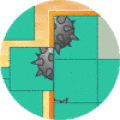
Play our new and exciting Skunk puzzle. Complete this beautiful puzzle. See how fast you can complete this puzzle.
Free
Download (331 Kb)
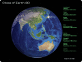
Cities of Earth Free 3D Screensaver 2.1
Cities of Earth is a free beautiful 3D screensaver which shows biggest cities of our planet.
Free
Download (1.67 Mb)

Plex.Earth Tools for AutoCAD 1.1.317
AutoCAD plug-in for advanced geographic interaction with Google Earth. Cover large areas with color imagery. Geo-locate site plans. Unique productivity tool with ???must-have??? features necessary for all engineers and architects.
$109.00
Download (1.6 Mb)

GoogleEarthTweaker 1.08
If you use Google Earth to prepare for your Geocaching trips, then you'll know that it's often difficult to find the right caches and to see which ones you already visited. This program makes it easier by preparing your GPX files for Google Earth.
Free
Download (300 Kb)

Satelite Earth 1
Imagenes satelite is a free satelite images slideshow screensaver for your desktop.View high resolution and beautihigh quality satelite images of earth from space.This screensavers contains full color images that fit automatically on your screen.
Free
Download (3.27 Mb)
Free 3D Earth Screensaver 1.1
Put this extremely realistic 3D Earth screensaver on your monitor and find yourself on an orbital station ready to make your own space research of our home planet. With this free screensaver you will see the unforgettable views of the Earth!
Free
Download (4.47 Mb)

Earth Photo Screensaver 1.0
While your computer is idle, five full size pictures taken from outer space will give you the opportunity to see how beautiful the Earth is. Don't miss the chance to experience piece and tranquility with photos of our planet.
Free
Download (1.47 Mb)

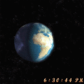
Actual Earth 3D 1.2
Display realistic model of the Earth on a background of twinkling stars. You can see times of rising/setting of Moon and Sun. You can configure the product as your Screen Saver.
Free
Download (1.03 Mb)