|
|
?????»????????: ???????µ???‚ ???µ?¶?µ???°?????? 4.12.5
Range: the land surveying Project is a program for the registration of the project of a land surveying of the ground areas made according to requirements, confirmed by the order of Ministry of economic development Russia from August, 3rd, 2011 #388.
free download (5.04 Mb)
|
|
|
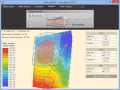
Terra Excess 25.1217
Terra Excess is land surveying and civil engineering CAD software developed to be extremely intuitive. It can be used for creating topographic plans and maps, calculating stockpile, quarry and earthwork volumes or editing and viewing survey points.
free download trial (32 Mb)
|
|

|
Draft Survey 8.0
Draft Survey is a user-friendly draught survey calculation program for Ships Officers and Marine Surveyors. It complies with the latest UN ECE standards for Draught Surveying and can print to all standard printer types.
free download trial (2.18 Mb)
|
|
|
|
|

|
Maritime Software Suite 9.7
Maritime Software Suite is a Draft Survey, Lashing, Route calculation program for Ships Officers and Marine Surveyors. It complies with the latest UN ECE standards and MSC Code of Safe Practice for Cargo Stowage and Securing for Draught Surveying.
free download trial (9.79 Mb)
|
|
|
?????»???????? 2012 5.0
"Range" is a unique program for automation of a land surveying and tap of the earths.
free download (3.3 Mb)
|
|

|
PriMus v500c
PriMus garantees integrated management of Price Books, Bills of Quantities and Rate Analysis.
It has specific features to address any kind of Estimating or Quantity surveying issue and is easier and more effective than any other generic software.
free download (32 Mb)
|
|
|
|
|
|
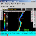
RTOPO 3.3
Simple, powerful and inexpensive CAD software for surveying. You can do triangulation, isolines, color-filled contour maps, sections, intersections, volume and editing XYZ files. You can process hundreds of thousands of points or triangles.
free download trial (1.04 Mb)
|
|

|
RTOPO Hydrology 3.4
Simple, powerful and inexpensive CAD software for surveying. You can do triangulation, isolines, color-filled contour maps, sections, intersections, volume, simulation of rainwater runoff and editing XYZ files.
free download trial (2.48 Mb)
|
|

|
Marine Draught Survey 1.00
Marine Draught Survey is a user-friendly Draught Survey software for Marine Surveyors and Ships Officers. Marine Draught Survey is easily operated using either mouse or keyboard.
free download trial (3.53 Mb)
|
|

|
Ancient Egypt 3D Screensaver 1.0
In Egypt, ancient civilization began around 3000 BC under the first Pharaoh and it developed over the next three millennia. For a moment you can enjoy the spirit of ancient Egypt with this 3D screensaver.
free download trial (11.8 Mb)
|
|
Pages : 1 | 2
| 3
| 4
|
|
|
|
