|
|
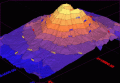
3DField 3.2.6
3DField is a contouring plotting and 3D data program. It converts your data into contour maps, surface or volume plots. Rotate image
free download trial (3.15 Mb)
|
|
|
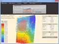
Visual Data For Academic 3.2.0
Scientific data visualization software. Creating vertex, grid and surface model, color map, contour plot, vector plot, 4D scatter, 4D slice and 4D vector.
free download trial (3.15 Mb)
:: order online ($150.00)
|
|
|
Terra Excess 25.1217
Terra Excess is land surveying and civil engineering CAD software developed to be extremely intuitive. It can be used for creating topographic plans and maps, calculating stockpile, quarry and earthwork volumes or editing and viewing survey points.
free download trial (32 Mb)
|
|
|
|
|
|
OutlineArt 1.9
AutoCAD Text Editor - OutlineART,applied in CAD wordprocessing,is a tool to transform words and symbols into vector-contour,we provide both windows desktop version and ARX embedded version for AutoCAD(R14 to 2006)
free download trial (890 Kb)
|
|
|
FotoBeschriften 6.6.3.447
Labeling enriches photos. Useful, if one liked to distribute they. 'FotoBeschriften' is customized. Unskilled users achieve fast good results. Graphic ideas do not only have to be developed and realized pedantically.
free download trial (7.54 Mb)
|
|
|
RTOPO 3.3
Simple, powerful and inexpensive CAD software for surveying. You can do triangulation, isolines, color-filled contour maps, sections, intersections, volume and editing XYZ files. You can process hundreds of thousands of points or triangles.
free download trial (1.04 Mb)
|
|
|
|
|
|
VisionLab VC++ 5.0.3
Visual C++ Advanced Computer Vision Library. Motion, and Image recognition (Canny, Hough Lines, Contour Finder, and more). Allows rapid development with zero lines of code. Includes video capture components. Free for non-commercial use.
free download trial (32 Mb)
|
|

|
RTOPO Hydrology 3.4
Simple, powerful and inexpensive CAD software for surveying. You can do triangulation, isolines, color-filled contour maps, sections, intersections, volume, simulation of rainwater runoff and editing XYZ files.
free download trial (2.48 Mb)
|
|
|
TRIANGULATION for IntelliCAD 3.9
TRIANGULATION, ISOLINES, VOLUME, LOADING of XYZ points files, 3DINTERSECTION and sections, color-filled contour map ; 7 functions for IntelliCAD versions which can load SDS applications (dll).
free download trial (587 Kb)
|
|

|
Pixopedia 2014 0.0.6
A new approach to image editing and painting. Perform any action through brush movement. Realtime 3D brushing and instant shadowing. New warping methods, facial deformations. Autobrush technique with contour tracking.
free download (15.73 Mb)
|
|
Pages : 1 | 2
| 3
| 4
| 5
|
|
|
|
