|
|
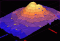
3DField 3.2.6
3DField is a contouring plotting and 3D data program. It converts your data into contour maps, surface or volume plots. Rotate image
free download trial (3.15 Mb)
|
|
|
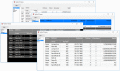
TeeGrid 1.0
Grid Component for Embarcadero RAD Studio, Delphi and C++, VCL and Firemonkey frameworks and Lazarus FreePascal. TeeGrid is a lightweight full-featured Grid / Tabular control written from scratch (not derived from TCustomGrid or TGrid).
free download trial (32 Mb)
|
|
|
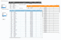
TeeGrid for .NET 2018
The Grid Control for NET offers a very fast data grid for your Visual Studio projects. Includes NET Core support and improved javascript visualisation via jsGrid.
free download trial (930 Kb)
|
|
|
|
|
Pages : 1
|
|
|
|
