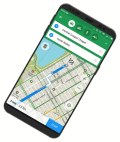
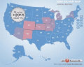
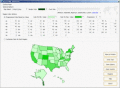
PolyMap is a desktop mapping program that lets you use your own data to customize the maps supplied with the program. The Map Presentation Wizard gives you a step-by-step process to customize your map and the maps legend.
Free standalone software DataPult Desktop creates heat maps from your data quickly and efficiently. The ability to create interactive animated map of data over several years. Pie, bubble and other diagrams types available. Import from Excel.
A great and useful stuff tool for 3dsmax(especially for architecture design)* It can add unlimited number of material spheres and assign materials to objects swiftly.* Quick remove missing maps(remove Paths or Materials of missing maps).
Stitch maps together to build one overall map. Join and calibrate your Google Earth images to one shared map. The program StitchMaps simply joins these maps. The result is a map that is suitable for programs using raster scan.
Anychart Flash Maps Flexible XML-Driven solution: US, World, US Counties. You can add background and captions, XML data file and a set of customizable options make AnyChart Maps a universal solution for web developers.
Nevron Map for SharePoint is an advanced web part for all versions Microsoft SharePoint. It is designed to provide an easy and powerful way to create choropleth maps that are tightly integrated with your data.
Flash maps suitable for Real-Estate, Dealer Maps, Branch Offices Locators.
Set states clickable with hyperlinks (URL).
Define colour for each state.
Full FLA source file, SWF available.
All adjustment are produced in source FLA.
Nevron Map for Reporting Services is an advanced report for all versions Microsoft Reporting Services. It is designed to provide report authors with an easy and powerful way to create choropleth maps that are tightly integrated with your data.
a tool to make region map with self-definition color. The original maps in the software are blank political region ones for different countries or areas. You can color any region with whatever color as you like.