|

|
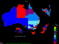
FusionMaps 3.0.6
FusionMaps v3 helps you create animated, interactive and data-driven Flash Maps for your dynamic web applications. Using FusionMaps, you can display geographical data distributed by category, regions or entities.
free download trial (26.77 Mb)
|
|

|
OzGISMac 14.7-14.11.2020
OzGISMac is an extensive system for the analysis and display of geographically referenced data. The system can be used to analyze socio-economic and demographic data produced by censuses and surveys and to support management decisions.
free download (307 Kb)
|
|

|
FPS Maps for WPF 1.1.01
FPS Maps for WPF is a brand new component with a set of built-in country maps. There are 15 Inbuilt Countries. Maps navigation can be performed via Navigation bar which supports Themes and mouse.
free download trial (1.12 Mb)
|
|
|
|
|
|
OzGIS 14.7.0.7
OzGIS is an extensive system for the analysis and display of geographically referenced data. The system can be used to analyze socio-economic and demographic data produced by censuses and surveys and to support management decisions.
free download (313 Kb)
|
|
|
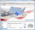
IMapBuilder Interactive Flash MapBuilder 4.55
iMapBuilder is an easy-to-use, powerful, WYSIWYG Flash map building tool for non-technical users. It is an all-in-one software that creates professional Flash maps quickly and easily without any programming skills or additional software.
free download trial (8.82 Mb)
|
|

|
Yahoo Satellite Maps Downloader 5.19
Yahoo Satellite Maps Downloader is a cute tool that can automatically download Yahoo satellite maps small tile map images and then combine them into one big map image. It supports multithreads, so the download speed is very fast.
free download trial (953 Kb)
|
|
|
|
|

|
Easy OpenstreetMap Downloader 5.0
Easy OpenstreetMap Downloader is a tool that help you to get small tile images from openstreetmap. You can view downloaded maps by Maps Viewer Or you can combine them into a big BMP map by Maps Combiner.
free download trial (1.26 Mb)
|
|
|
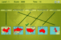
Mapping Maps 1.1.3
Can you name all of the given lands on the map?
free download (295 Kb)
|
|

|
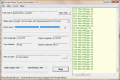
Eye4Gps GPS mapping software 3.0
GPS Mapping Software for Windows, Loading topographic maps, Realtime navigation and more. The software can be used with various map formats including: GeoTiff, OpenStreetMap XML, BSB Nautical Charts, AutoCad DXF files, ESRI Shapefiles and image files
free download trial (8.3 Mb)
|
|
|
Google Maps Terrain Downloader 6.325
Google Maps Terrain Downloader is a cute tool that can automatically download Google Maps small tile terrain map images and then combine them into one big map image. It supports multithreads, so the download speed is very fast.
free download trial (1.17 Mb)
|
|
Pages : 1
| 2 | 3
| 4
| 5
|
|
|
|
