Free 3d concept maps downloads, showing 31 - 40 of about 50

Polymap 3.1.0
PolyMap is a desktop mapping program that lets you use your own data to customize the maps supplied with the program. The Map Presentation Wizard gives you a step-by-step process to customize your map and the maps legend.
$89.95
Download (7.37 Mb)
Google Maps Terrain Downloader 6.325
Google Maps Terrain Downloader is a cute tool that can automatically download Google Maps small tile terrain map images and then combine them into one big map image. It supports multithreads, so the download speed is very fast.
$29.95
Download (1.17 Mb)

Flash for Google Maps DW Extension 1.0.1
Flash Google Maps for Adobe Dreamweaver!
Google Maps, Flash Google maps for web, dreamweaver extensions, Google Maps for dreamweaver, google flash component
$34.90
Download (827 Kb)
Google Maps Contact Extractor 2.0.0.0
Our Google Maps scraper is a versatile, lightweight and powerful Google Maps scraper tools. Google Maps Contact Extractor is a software that extracts information such as business names, address, phone numbers, rating, websites, opening hours, email
google maps scraper, google places scraper, contact extractor, telemarketing data list builder, marketing data software
$119.95
Download (32 Mb)
Visual Complex For Academic 1.6
Visual Complex is a graph software to create graph of complex function. 3D function graphs and 2D color maps can be created with this grapher.
$30.00
Download (1.86 Mb)

FusionMaps 3.0.6
FusionMaps v3 helps you create animated, interactive and data-driven Flash Maps for your dynamic web applications. Using FusionMaps, you can display geographical data distributed by category, regions or entities.
$199.00
Download (26.77 Mb)

DataPult Desktop 3.1
Free standalone software DataPult Desktop creates heat maps from your data quickly and efficiently. The ability to create interactive animated map of data over several years. Pie, bubble and other diagrams types available. Import from Excel.
Free
Download (20.96 Mb)

StitchMaps 2
Stitch maps together to build one overall map. Join and calibrate your Google Earth images to one shared map. The program StitchMaps simply joins these maps. The result is a map that is suitable for programs using raster scan.
$45.00
Download (554 Kb)
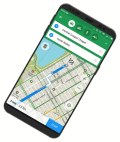
MAPS.ME for Android 8.1.3
Access worldwide offline maps with navigation & driving directions! Travel easy!
Free
Download (32 Mb)