|

|
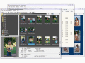
Automatic Photo Organizer 3.96
Organize All your photos automatically with Automatic Photo Organizer. Organize photos in variety of photo formats (more than 867 total) + Organize photos using variety of EXIF / IPTC / XMP photo tags (more than 9872). All photos will be organized!
free download trial (16.82 Mb)
:: order online ($39.95)
|
|

|
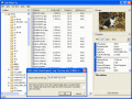
Ideal Photo Sorter 4.37
Sort All your photos automatically with Ideal Photo Sorter. Sort photos in variety of photo formats (more than 867 total) + Sort photos using variety of EXIF / IPTC / XMP / FlashPix photo tags (more than 9872 total and increasing).
free download trial (14.29 Mb)
:: order online ($39.95)
|
|
|
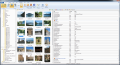
Picture Information Extractor 5.76
The deluxe photo data toolkit. Free image browser that extracts all metadata from JPG and RAW, downloads from digital cameras, renames automatically, rotates losslessly. Geotagging with interactive map. File manager and fast viewer with slide show.
free download (3.94 Mb)
|
|
|
|
|
|
Picmeta PhotoTracker 1.5
Picmeta PhotoTracker automatically geotags photos based on track information from any GPS device (.gpx files). It writes GPS EXIF data to JPG, TIFF and RAW formats.
free download (5.3 Mb)
|
|
|
Metadata++ 1.21.21
Edit, display, modify, add metadata to any multimedia file.
free download (7.34 Mb)
|
|
|
Exif Pilot Pro 4.1.0
Edit, create, and view EXIF, EXIF GPS, and IPTC data. Supported file-formats: - JPEG, TIFF, PNG, DNG, NEF, PEF, CRW, JP2, PSD - reading, creating, and editing; - RAW formats, including CR2, MRW, ARW, SR2, ORF and RAF - reading only.
free download trial (2.43 Mb)
|
|
|
|
|

|
Photo Collection Organizer 2.14
Organize, sort and rename All photos automatically with Photo Collection Organizer, sorter. Organize photos in variety of photo formats (more than 792) + Organize photos using variety of EXIF / IPTC / TIFF photo tags. All photos will be organized!
free download trial (11.37 Mb)
:: order online ($39.95)
|
|
|
RoboGEO 5.6.20
Geotag photos from a GPS. Stamp the images or write to the EXIF headers. Export Google Maps, KML KMZ files for Google Earth, Shapefiles (SHP), AutoCAD DXF files, or Flickr. Import from tracklogs, waypoints, GPX or place names.
free download trial (9.28 Mb)
|
|
Pages : 1
|
|
|
|
