|

|
ShapeView 2.3
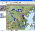
It is a FREE ESRI shape files (*.shp), MapInfo interchange (*.mif) and *.dxf files viewer. Using this utility you can view *.shp files (ESRI shape files) and *.mif files (MapInfo interchange). No other files are needed. Source codes are available.
free download (346 Kb)
|
|

|
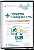
?????»????????: ?????????µ???‚?µ?? XML 2.0.7.0
The program "Range: the XML Converter is designed to convert a cadastral XML files of any size issued (handed) Rosreestra, in MIF/MID format (MapInfo), DXF (AutoCAD) and other formats, get files.
free download (5.16 Mb)
|
|

|
MPSuperShape 2.6
MPSuperShape is a shape manipulation tool for Microsoft MapPoint. MPSuperShape can combine shapes, find overlaps, find boundaries, and import/export various files. MapPoint 2006, .NET Framework 2.0 (or later), and Windows XP or Vista required.
free download trial (13.54 Mb)
|
|
|
|
|

|
AvisMap Free Viewer 5.3.1
The free AvisMap Viewer opens most GIS/CAD and raster image file types and most ArcView, ArcExplorer, and MapInfo projects. Besides just opening and viewing files, the Viewer supports an extensive list of features.
free download (22.28 Mb)
|
|

|
Salesforce ODBC driver (32/64 bit) 1.5
Devart ODBC Driver for Salesforce provides high-performance and feature-rich connectivity solution for ODBC-based applications to access Salesforce.com, Force.com cloud CRM and Database.com cloud databases from Windows, both 32-bit and 64-bit.
free download trial (11.35 Mb)
|
|

|
?????»????????: ???°???‚?° ???»?°?? 5.1.1
"Polygon" is a unique program for automation of installation of borders of the ground areas and tap of the earths. The program carries out calculation of the geodata, builds the plan of borders of the earths, forms land management business.
free download (7.65 Mb)
|
|
|
|
|

|
Vextractor 6.50
Vextractor is a vectorizer program for transforming raster images to vector formats. This tool could be used for the vectorizing of drawings, maps, photo, logotypes and other line art images for input to CAD, GIS or Vector Graphics Design software.
free download trial (2.97 Mb)
|
|

|
Vextractor x64 5.50
Vextractor is a vectorizer program for transforming raster images to vector formats. This tool could be used for the vectorizing of drawings, maps, photo, logotypes and other line art images for input to CAD, GIS or Vector Graphics Design software.
free download trial (3.99 Mb)
|
|

|
Magento ODBC Driver (32/64 bit) 2.0
Devart ODBC Driver for Magento provides high-performance and feature-rich connectivity solution for ODBC-based applications to access Magento cloud databases from Windows, both 32-bit and 64-bit.
free download trial (12 Mb)
|
|

|
?????»???????? 2012 5.0
"Range" is a unique program for automation of a land surveying and tap of the earths.
free download (3.3 Mb)
|
|
Pages : 1 | 2
| 3
|
|
|
|


