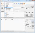
Free gis downloads, showing 31 - 40 of about 50

OzGIS 14.7.0.7

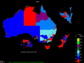
OzGIS is an extensive system for the analysis and display of geographically referenced data. The system can be used to analyze socio-economic and demographic data produced by censuses and surveys and to support management decisions.

Dxf2DwgDLL 3.50

Dxf2DwgDLL allows the programmers to convert dxf to dwg files and viceversa without the need of AutoCAD.You can use Dxf2Dwg DLL 3.50 in any your own application royalties free.DLL can be called from any application language supporting DLL calls.

Polymap 3.1.0

PolyMap is a desktop mapping program that lets you use your own data to customize the maps supplied with the program. The Map Presentation Wizard gives you a step-by-step process to customize your map and the maps legend.