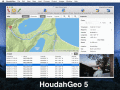
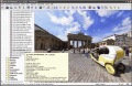
|
|
Panorado Flyer 1.2
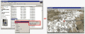
Panorado Flyer is a simple geocoding tool for linking JPEG image files to the location where the picture was taken, using geographical coordinates. It can be lauched from the Windows Explorer's context menu.
free download (221 Kb)
|
|
|
HoudahGeo 4.0.1
One-stop photo geocoding for the Mac: Know where you took that photo. Write geotags to EXIF, XMP & IPTC. See your photos in Google Earth. GPS device optional. Use with iPhoto, Aperture or Lightroom
free download trial (17.64 Mb)
|
|
|
CDXZipStream 10.2.1
CDXZipStream is a complete solution for analyzing address and census data into Microsoft Excel. CDXZipStream features geocoding, maps, zip code reports, reverse look-up, distance and radius calculations. Optional demographic data feeds are available.
free download trial (7.38 Mb)
|
|
|
|
|
OkMap 8.8.3
OkMap is a software that works with vectorial and raster maps that you have bought or scanned. OkMap lets you organize paths by creating waypoints, routes and tracks, and upload/download data to/from your GPS. OkMap supports GPS real-time navigation.
free download (20.21 Mb)
|
|
|
Photos Workbench 1.0
Companion to Apple Photos for Mac. Photos Workbench works with Apple Photos to help you organize, name, and compare your photos.
free download trial (5.54 Mb)
|
|
|
Geodata International 9.03
Geodata International - World-wide database of countries with georeferenced towns, municipalities, postal codes and administrative units with WGS84 and UTM coordinates and elevations for geocoding, proximity search, navigation, distance calculation.
free download trial (1.97 Mb)
|
|
|
|
|
Geodaten International 6.01
Geodata International - World-wide database of countries with georeferenced towns, municipalities, postal codes and administrative units with WGS84 and UTM coordinates and elevations for geocoding, proximity search, navigation, distance calculation.
free download trial (785 Kb)
|
|
|
MyExifLibrary 1.0
MyExifLibrary is fully managed .NET Framework easy-to-use library for .NET Framework 2.0 designed for reading, editing and saving the EXIF (Exchangeable Image File Format) data embeded in images taken from digital cameras.
free download trial (792 Kb)
|
|
|
Polymap 3.1.0
PolyMap is a desktop mapping program that lets you use your own data to customize the maps supplied with the program. The Map Presentation Wizard gives you a step-by-step process to customize your map and the maps legend.
free download trial (7.37 Mb)
|
|
|
Panorado 4.0
Comfortable image viewer supporting panoramic pictures and HDR pictures. Instant 360-degree viewing. Navigation bar, organizer, thumbnails, full screen, slide shows, printing, picture disk creation. 14 file formats + QTVR+RAW+HDR. EXIF/IPTC support.
free download trial (2.65 Mb)
|
|
Pages : 1
|
|
|
|