|

|
TRANSDAT 20.40
TRANSDAT Coordinate Conversion supports thousands of coordinate systems and geodetic datum shifts, user-defined systems, INSPIRE, NTv2, BeTA2007, GPS, continental drift, Shape, KML, CSV and other file systems and much more with highest accuracy.
free download trial (4.42 Mb)
|
|
|
TRANSDAT (English) 16.01
TRANSDAT Coordinate Conversion supports thousands of coordinate systems and geodetic datum shifts, user-defined systems, INSPIRE, NTv2, BeTA2007, GPS, continental drift, Shape, KML, CSV and other file systems and much more with highest accuracy.
free download trial (2.49 Mb)
|
|

|
TRANSDAT English 17.44
TRANSDAT Coordinate Conversion supports thousands of coordinate systems and geodetic datum shifts, user-defined systems, INSPIRE, NTv2, BeTA2007, GPS, continental drift, Shape, KML, CSV and other file systems and much more with highest accuracy.
free download trial (2.91 Mb)
|
|
|
|
|
|
ProgeCAD Professional 2009 DWG CAD 9.0.22.5
AutoCAD-like professional design at one tenth the cost. progeCAD can read edit view plot and convert DWG DXF etc. Download includes 11000 AutoCAD blocks. Supports PDF, SVG XML, Google Earth KML, IntelliCAD AutoLISP & DIESEL, ACIS 3D Solids modeling.
free download trial (32 Mb)
|
|
|
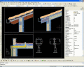
ProgeCAD Professional 2010 DWG CAD 10.0.10.8
AutoCAD LT compatible, high quality CAD software for building architectural civil and industrial engineering design. Supports PDF, SVG XML, Google Earth KML, IntelliCAD AutoLISP & DIESEL, ACIS 3D Solid modeling.
free download trial (32 Mb)
|
|
|
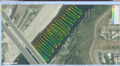
EdiTrail 1.0
Create/Edit/Display/Management/Import/Export Trails/Routes in a simple and flexible environment divided in a data table for the management of trails and a map resulting from numerous providers, (Bing, Arcgis, Ovi, Yahoo, etc).
free download (27.05 Mb)
|
|
|
|
|
|
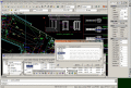
ProgeCAD 2016 Professional CAD Software 16.0.8.17
AutoCAD-like drawing software for architects, engineers, surveyors, designers and building professionals. Easily create complex drawings using progeCAD's AutoCAD-like interface, create DWG files for use in full versions of AutoCAD. Print PDF and more
free download trial (32 Mb)
|
|
|
Eye4Software Hydromagic 7.0.15.929
Hydrographic Survey Software for Windows, Load topographic or nautical maps, create singlebeam soundings, generate DTM's (Digital Terrain Models), generate depth contours, generate cross-sections, volume calculations and more.
free download trial (32 Mb)
|
|

|
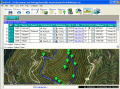
OkMap 8.8.3
OkMap is a software that works with vectorial and raster maps that you have bought or scanned. OkMap lets you organize paths by creating waypoints, routes and tracks, and upload/download data to/from your GPS. OkMap supports GPS real-time navigation.
free download (20.21 Mb)
|
|
|
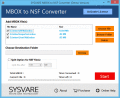
Create NSF from MBOX 1.0
Create NSF from MBOX within few simple steps. Create multiple NSF file from MBOX with bulk mode. Suitable tool for everyone who wants to create NSF from MBOX.
free download trial (3.16 Mb)
|
|
Pages : 1
| 2 | 3
| 4
| 5
|
|
|
|
