Civil Survey AutoCAD Clone Software, no learning curve for AutoCAD users, Natively reads and writes AutoCAD DWG files, no need for conversion! Includes Data Collector file Import, COGO, Contours, DTM, Road Design, Sections and Profiles.
IGES Import for AutoCAD is an IGES file import plug-in for AutoCAD?® and allows you to import GES model into AutoCAD?® for modeling or drafting in 2D/3D.
Range: the land surveying Project is a program for the registration of the project of a land surveying of the ground areas made according to requirements, confirmed by the order of Ministry of economic development Russia from August, 3rd, 2011 #388.
OBJ Import for AutoCAD is a Wavefront (.obj) file import plug-in for AutoCAD?®. This plug-in gives AutoCAD the ability to import geometric data from ASCII and Binary OBJ files.
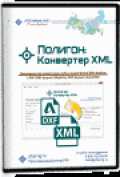
The program "Range: the XML Converter is designed to convert a cadastral XML files of any size issued (handed) Rosreestra, in MIF/MID format (MapInfo), DXF (AutoCAD) and other formats, get files.