Canvas 12 with GIS+
ACDSee Canvas 12 with GIS+ 12.00.1389
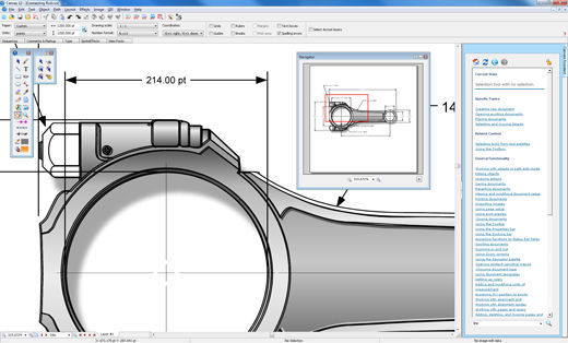
Canvas is the integrated application that speeds up and streamlines your technical illustration workflow. Professionals in high tech, complex environments that require accurate and powerful visualization of technical data rely on Canvas to facilitate collaboration and improve productivity.
Experience Canvas 12, the preferred solution for technical illustration in precision industries such as; aerospace and automotive, biotechnology and healthcare, education, government, manufacturing, oil, gas and energy, and technology.
Canvas??™ GIS+ module, included in this evaluation version, offers a powerful set of GIS-based tools and commands that support all leading GIS formats, define complex map projections, and perform advanced property operations.
Canvas provides you with a single integrated software environment for technical illustration. With Canvas, you can work with both vector objects and raster images in the same document. And you have access to a larger range of enhancement tools for any kind of graphic, rather than being limited to certain enhancements on vector objects and others on raster images. As a Canvas user, you have the ultimate in flexibility, with the ability to import existing graphics from over a hundred different standard and specialized formats. Depending on your requirements and preferences, you can draw and edit either freehand or numerically for ultimate precision. Canvas also provides you with the ability to complete your workflow in one application, with its advanced text capabilities, as well as its set of tools for publishing, presenting and collaborating.
In specialized workflows that require high level format support and sophisticated methods of data acquisition, visualization and analysis, Canvas has the crucial ability to accurately measure, edit, and export digital images that contain up to 32 bits per channel of data.
Keywords:
Technical illustration, CAD, 3D, precision drawing, aerospace, biotechnology manufacturing, oil, gas, vector, raster, WebCGM, CGM, CGM4, flowchart, GIS, visualization, technical graphics, dimensioning, IEEE