|
|
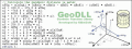
BetaDLL 2.01
BetaDLL contains precise functions for coordinate transformations and datum shifts using the German NTv2 standard BeTA2007. The Functions of the 32 bit / 64 bit DLL can be easy called from own applications.
free download trial (1020 Kb)
|
|
|
Geodata International 9.03
Geodata International - World-wide database of countries with georeferenced towns, municipalities, postal codes and administrative units with WGS84 and UTM coordinates and elevations for geocoding, proximity search, navigation, distance calculation.
free download trial (1.97 Mb)
|
|
|
Geodaten International 6.01
Geodata International - World-wide database of countries with georeferenced towns, municipalities, postal codes and administrative units with WGS84 and UTM coordinates and elevations for geocoding, proximity search, navigation, distance calculation.
free download trial (785 Kb)
|
|
|
|
|
|
Geo Data International Admin 4.00
Geo data international world-wide with towns, town quarters and postal codes. Georeferences as UTM- and geographic coordinates (WGS84) and elevations. Suitable for branch searches, periphery searches and distance computations. dBase, CSV, SDF, SQL.
free download trial (936 Kb)
|
|

|
TOPOWIN 16.03
TOPOWIN is a state-wide register of the German topographic cartographies and of localities with geo references in different coordinate systems. It also is a topographic information system.
free download trial (4.06 Mb)
|
|
|
TOPOWIN English 13.00
TOPOWIN is a state-wide register of the German topographic cartographies and of localities with geo references in different coordinate systems. It also is a topographic information system.
free download trial (3.42 Mb)
|
|
|
|
|
|
ORTWIN 13.02
ORTWIN is a program for the inquiry of localities in Germany. It finds postal zip codes, telephone pre selections, coordinates. It performs perimeter searches and distance calculations. It finds landscapes, natural units, snow- and wind load zones.
free download trial (4.36 Mb)
|
|

|
ORTWIN English 10.00
ORTWIN is a program for the inquiry of localities in Germany. It finds postal zip codes, telephone pre selections, coordinates. It performs perimeter searches and distance calculations. It finds landscapes, natural units, snow- and wind load zones.
free download trial (3.7 Mb)
|
|
|
TRANSDAT English 17.44
TRANSDAT Coordinate Conversion supports thousands of coordinate systems and geodetic datum shifts, user-defined systems, INSPIRE, NTv2, BeTA2007, GPS, continental drift, Shape, KML, CSV and other file systems and much more with highest accuracy.
free download trial (2.91 Mb)
|
|

|
DRAGSENS 1.01
DRAGSENS Geo Software is used for the exact position estimation of a towed body, sensor, camera, array or net, dragged behind a ship, aircraft or vehicle. The software allows a real-time estimation of the position of a dragged sensor.
free download trial (1.76 Mb)
|
|
Pages : 1 | 2
|
|
|
|
