|
|
Teach2000 8.51
Teach2000 is a private teacher to help you memorize a foreign language, topography or even the history of Italy by dates. Improve your school results with this free language trainer. Teach2000 supports unicode fonts.
free download (7.85 Mb)
|
|

|
Satellite Image Browser 2.0
Satellite Image Browser is a Shareware Mac OS X application that can be used to display and print topographical satellite images.
free download trial (2.54 Mb)
:: order online ($20.00)
|
|

|
Trip 2 Kashmir 1.0
As everybody knows that Kashmir is a paradise on earth this is famous word so we have options trip to Kashmir vacations for looking memorable places of Kashmir. Trip to Kashmir gives Kashmir traveler packages in low prices with Kashmir travel agents.
free download (3.31 Mb)
|
|
|
|
|

|
Trip To Kashmir 1.0
Trip to Kashmir is like paradise travel on Earth, We have plan for trip to Kashmir traveler & tourists. Trip to Kashmir provides all Kashmir traveler packages in nominal prices with Kashmir agents.
free download (3.31 Mb)
|
|
|
TRIANGULATION for AutoCAD 2.1
An add-on for AUTOCAD, for the TRIANGULATION of a set of point, isolines, KML creator, the VOLUME of a set of 3dface entities, loading of XYZ points files and sections.
free download trial (648 Kb)
|
|
|
TRIANGULATION for IntelliCAD 3.9
TRIANGULATION, ISOLINES, VOLUME, LOADING of XYZ points files, 3DINTERSECTION and sections, color-filled contour map ; 7 functions for IntelliCAD versions which can load SDS applications (dll).
free download trial (587 Kb)
|
|
|
|
|
|
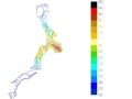
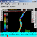
RTOPO 3.3
Simple, powerful and inexpensive CAD software for surveying. You can do triangulation, isolines, color-filled contour maps, sections, intersections, volume and editing XYZ files. You can process hundreds of thousands of points or triangles.
free download trial (1.04 Mb)
|
|

|
RTOPO Hydrology 3.4
Simple, powerful and inexpensive CAD software for surveying. You can do triangulation, isolines, color-filled contour maps, sections, intersections, volume, simulation of rainwater runoff and editing XYZ files.
free download trial (2.48 Mb)
|
|
|
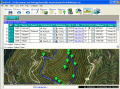
EdiTrail 1.0
Create/Edit/Display/Management/Import/Export Trails/Routes in a simple and flexible environment divided in a data table for the management of trails and a map resulting from numerous providers, (Bing, Arcgis, Ovi, Yahoo, etc).
free download (27.05 Mb)
|
|
Pages : 1
|
|
|
|
