|

|
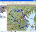
ShapeView 2.3
It is a FREE ESRI shape files (*.shp), MapInfo interchange (*.mif) and *.dxf files viewer. Using this utility you can view *.shp files (ESRI shape files) and *.mif files (MapInfo interchange). No other files are needed. Source codes are available.
free download (346 Kb)
|
|

|
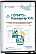
?????»????????: ?????????µ???‚?µ?? XML 2.0.7.0
The program "Range: the XML Converter is designed to convert a cadastral XML files of any size issued (handed) Rosreestra, in MIF/MID format (MapInfo), DXF (AutoCAD) and other formats, get files.
free download (5.16 Mb)
|
|

|
Total GIS Converter 1.1
Total GIS Converter is a powerful converter on GIS files. It converts AEP, GRD, ADF, E00, FLT, APR, SHP, DXF, BT, TOC, RT1, DEM, DLG, ECW, IMG, DGF, GML, SID, MIF, TAB, WOR, DNG, DDF, BIL, JPEG, TTKPS, TTKLS, LFT, PFT, TFT to TIFF, PNG, JPEG, BMP.
free download trial (4.47 Mb)
:: order online ($99.90)
|
|
|
|
|

|
MPSuperShape 2.6
MPSuperShape is a shape manipulation tool for Microsoft MapPoint. MPSuperShape can combine shapes, find overlaps, find boundaries, and import/export various files. MapPoint 2006, .NET Framework 2.0 (or later), and Windows XP or Vista required.
free download trial (13.54 Mb)
|
|

|
Vextractor 6.50
Vextractor is a vectorizer program for transforming raster images to vector formats. This tool could be used for the vectorizing of drawings, maps, photo, logotypes and other line art images for input to CAD, GIS or Vector Graphics Design software.
free download trial (2.97 Mb)
|
|

|
Vextractor x64 5.50
Vextractor is a vectorizer program for transforming raster images to vector formats. This tool could be used for the vectorizing of drawings, maps, photo, logotypes and other line art images for input to CAD, GIS or Vector Graphics Design software.
free download trial (3.99 Mb)
|
|
|
|
|

|
?????»????????: ???????µ???‚ ???µ?¶?µ???°?????? 4.12.5
Range: the land surveying Project is a program for the registration of the project of a land surveying of the ground areas made according to requirements, confirmed by the order of Ministry of economic development Russia from August, 3rd, 2011 #388.
free download (5.04 Mb)
|
|

|
Pdf2cad 8.0
pdf2cad converts PDF drawings into the DXF and HPGL formats for import as scalable and editable objects in AutoCAD, UniGraphics, Microstation and other CAD, CAM and CNC systems. Options for controling layering, line widths, scale and more.
free download trial (5.02 Mb)
:: order online ($195.00)
|
|

|
AnyCount Word Count and Line Count 7
AnyCount is automatic text count software. AnyCount is automatic line count, character count and word count software for all common file formats. Supports RTF, DOC, WPD, XLS, PPT, PPS, PDF, CSV, HTM, HTML, XML, MIF, TXT, ZIP, ODT, SDW, SXW, ODS, SDC
free download trial (32 Mb)
|
|

|
AnyCount: Word Count and Line Count 8
AnyCount is automatic text count, line count, character count and word count software for all common file formats. Supports RTF, DOC, DOCX, XLS, XLSX, PPT, PPS, PDF, CSV, HTM, HTML, TXT, ZIP, ODT, ODS, ODP, PUB, CHM, HLP, RAR, VSD, BMP, JPG, PNG, GIF
free download trial (32 Mb)
|
|
Pages : 1 | 2
|
|
|
|


