|

|
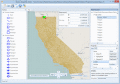
Graph Earth 0.9.5
Visualize your data in 3D! Quick, easy and inexpensive. Graph Earth enables business professionals to create stunning visual representations of their data, all without the time and costs associated with a full-feature GIS.
free download trial (469 Kb)
|
|

|
OkCustomMap 1.0.0
OkCustomMap is a software to produce Garmin Custom Maps. Supports many map formats, JPEG quality, KML transparency, draw order, image scaling and filters. You can customize the size of the tiles or the tiles number horizzontally or vertically.
free download (3.22 Mb)
|
|

|
Manco Shapefile Editor 2.0.0.0
Manco Shapefile Editor is a powerful tool for creating and editing shapefiles. Edit geometry of shapes easily. Add multiple images and enable an OpenStreetMap provider. Edit all the layers data at any time. Export your images to the shapefiles.
free download trial (5.33 Mb)
|
|
|
|
|
|
Manco Shapefile Editor 3.1.0.0
Manco Shapefile Editor is a powerful tool for creating and editing shapefiles. Edit geometry of shapes easily. Add multiple images and enable an OpenStreetMap provider. Edit all the layers data at any time. Export your images to the shapefiles.
free download trial (6.14 Mb)
:: order online ($100.00)
|
|

|
NMEA Converter 1.0
NMEA Converter is a product to convert various types of data, NMEA to UDP Converter, UDP to NMEA Converter, GPS to HDT Converter, NMEA to KML Converter, NMEA to KMZ Converter, KML to NMEA Converter
free download trial (509 Kb)
|
|
|
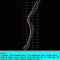
TRIANGULATION for AutoCAD 2.1
An add-on for AUTOCAD, for the TRIANGULATION of a set of point, isolines, KML creator, the VOLUME of a set of 3dface entities, loading of XYZ points files and sections.
free download trial (648 Kb)
|
|
|
|
|

|
Maps Package 1
There are very easy to customize via XML. You don't need to know Flash. The maps are 100% vectorial graphic. Get 20 maps at the price of 6. This package contains: XML Canada Map, XML USA Map, XML Central America, XML South America, XML Europe Map, XM
free download trial (100 Kb)
|
|
|
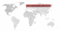
Interactive Flash World Map 1.0
An elegant interactive flash map of the world. This interactive world map includes 165 clickable countries. Display country statistics, country-specific information or mark pinpoint locations. The map uses XML and is easy to customize or install.
free download (864 Kb)
|
|

|
Flash Map WestVirginia 1.2
Dongsoft Interactive Flash Maps for websites, interactive map applications, presentations, and more.
free download (156 Kb)
|
|
|
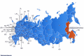
Free Russia Flash Map 1.3
Dongsoft Interactive Russia Flash Maps for websites, interactive map applications, presentations, and more.
free download (156 Kb)
|
|
Pages : 1 | 2
| 3
| 4
| 5
|
|
|
|
