|

|
GoogleEarthTweaker 1.08
If you use Google Earth to prepare for your Geocaching trips, then you'll know that it's often difficult to find the right caches and to see which ones you already visited. This program makes it easier by preparing your GPX files for Google Earth.
free download (300 Kb)
|
|
|
Picmeta PhotoTracker 1.5
Picmeta PhotoTracker automatically geotags photos based on track information from any GPS device (.gpx files). It writes GPS EXIF data to JPG, TIFF and RAW formats.
free download (5.3 Mb)
|
|
|
Final Selection 1.2.0
With Final Selection you can make the selection of your photos as you have always wanted! Work with your RAW, JPEG, TIFF and PSD files. Resize, geolocate, connect your camera, print, export, document, add watermarks!
free download (11.67 Mb)
|
|
|
|
|
|
EdiTrail 1.0
Create/Edit/Display/Management/Import/Export Trails/Routes in a simple and flexible environment divided in a data table for the management of trails and a map resulting from numerous providers, (Bing, Arcgis, Ovi, Yahoo, etc).
free download (27.05 Mb)
|
|
|
IMocker for Mac 2.0.2
iMocker is a GPS spoofing application for iOS devices that allows users to change their device’s actual location for privacy protection or to bypass geographical restrictions.
free download trial (58.99 Mb)
|
|

|
Advanced Points Manager 1.0
The Advanced points manager imports points to AutoCAD drawing from different data sources. OLE-DB Database, SHP (ESRI shape file), GPX (GPS eXchange format), KML (Keyhole Markup Language), GML (Geography Markup Language), TXT, CSV.
free download trial (609 Kb)
|
|
|
|
|
|
Aiseesoft AnyCoord for Mac 1.0.18
When you do not want to share your location with others on Instagram, Facebook or other social platform, Aiseesoft AnyCoord for Mac can help you change your GPS location easily and quickly.
free download trial (71.93 Mb)
|
|
|
RoboGEO 5.6.20
Geotag photos from a GPS. Stamp the images or write to the EXIF headers. Export Google Maps, KML KMZ files for Google Earth, Shapefiles (SHP), AutoCAD DXF files, or Flickr. Import from tracklogs, waypoints, GPX or place names.
free download trial (9.28 Mb)
|
|
|
Mapyx Quo 2.1.7
Mapyx Quo enables you to connect your GPS to your PC. View information - elevation, distance, speed, ETA,etc... Quo supports: GE KML,GPX format,ESRI SHP,Geocaching,Garmin,Magellan,OziExplorer files and more. Includes importing your own scanned maps.
free download (32 Mb)
|
|
|
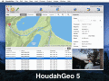
HoudahGeo 4.0.1
One-stop photo geocoding for the Mac: Know where you took that photo. Write geotags to EXIF, XMP & IPTC. See your photos in Google Earth. GPS device optional. Use with iPhoto, Aperture or Lightroom
free download trial (17.64 Mb)
|
|
Pages : 1 | 2
| 3
| 4
| 5
|
|
|
|
