|

|
Eye4Software GPS Toolkit 2.4
Toolkit to add GPS functionality to software (GPS SDK). All NMEA0183 protocol versions are supported, Garmin USB PVT support. Support for datum conversions and coordinate conversion using different map projections.
free download trial (595 Kb)
|
|
|
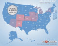
Flash Map USA Silver Special Edition (include FLA) 1.0
Flash maps suitable for Real-Estate, Dealer Maps, Branch Offices Locators.
Set states clickable with hyperlinks (URL).
Define colour for each state.
Full FLA source file, SWF available.
All adjustment are produced in source FLA.
free download trial (140 Kb)
|
|
|
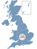
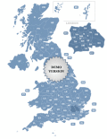
Golden UK Map 1.0
Golden UK Map. Special visual effect. Features: - Color, URL linking, captions and more; - Intuitive Flash Map Interface; - Ease of Use; - Customizations via an XML file; www.fla-shop.com
free download trial (341 Kb)
|
|
|
|
|
|
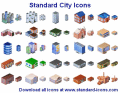
Standard City Icons 2010.1
Create city maps that look perfect on screen and on paper. Standard City Icons come in a variety of sizes and resolutions, making city plans perfectly legible on any media from PDA screens to poster-size prints in raster and vector formats.
free download trial (2.72 Mb)
|
|
|
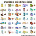
Desktop Building Icons for Bada 2015.1
A collection of 3D icons representing buildings, houses and various architecture objects of city infrastructure, Desktop Building Icons for Bada are here to help design the look and feel of a perfect architectural planning or mapping suite.
free download trial (112 Kb)
|
|
|
Postcode Map of UK 3.6
Postcode Map of UK. Features: - Color, URL linking, captions and more; - Intuitive Flash Map Interface; - Ease of Use; - Customizations via an XML file; www.fla-shop.com
free download trial (162 Kb)
|
|
|
|
|

|
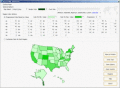
US County Zoom Map 2.0
A cool-looking Flash map of the U.S. with all counties. This zoom map features high customization capabilities via a simple XML file. Texts, fonts, colors, popups messages and links are all adjustable.
free download trial (417 Kb)
|
|
|
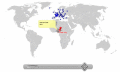
Pinpoint Locator Map of World 3.5
Pinpoint Locator Map of World for websites with wysiwyg editor tool. New release! Features: - Color, URL linking, captions and more; - Intuitive Flash Map Interface; - Ease of Use; - Customizations via an XML file
free download trial (528 Kb)
|
|

|
Map Export 2.6.1.0
Map Export is a GIS developer oriented tool for downloading and exporting background image. Map Export can export both satellite imagery and street maps from Google Map. It can export in many kinds of bmp format as you like.
free download trial (2.35 Mb)
:: order online ($499.95)
|
|
|
Region Map Generator 2.53
a tool to make region map with self-definition color. The original maps in the software are blank political region ones for different countries or areas. You can color any region with whatever color as you like.
free download trial (3.5 Mb)
|
|
Pages : 1
| 2
| 3 | 4
| 5
|
|
|
|
