|
|
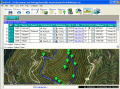
EdiTrail 1.0
Create/Edit/Display/Management/Import/Export Trails/Routes in a simple and flexible environment divided in a data table for the management of trails and a map resulting from numerous providers, (Bing, Arcgis, Ovi, Yahoo, etc).
free download (27.05 Mb)
|
|
|
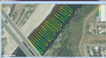
Eye4Software Hydromagic 7.0.15.929
Hydrographic Survey Software for Windows, Load topographic or nautical maps, create singlebeam soundings, generate DTM's (Digital Terrain Models), generate depth contours, generate cross-sections, volume calculations and more.
free download trial (32 Mb)
|
|

|
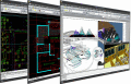
AvisMap Free Viewer 5.3.1
The free AvisMap Viewer opens most GIS/CAD and raster image file types and most ArcView, ArcExplorer, and MapInfo projects. Besides just opening and viewing files, the Viewer supports an extensive list of features.
free download (22.28 Mb)
|
|
|
|
|
|
ProgeCAD 2016 Professional CAD Software 16.0.8.17
AutoCAD-like drawing software for architects, engineers, surveyors, designers and building professionals. Easily create complex drawings using progeCAD's AutoCAD-like interface, create DWG files for use in full versions of AutoCAD. Print PDF and more
free download trial (32 Mb)
|
|
Pages : 1
| 2
| 3
| 4
| 5
|
|
|
|
