|
|
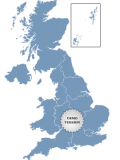
Golden UK Map 1.0
Golden UK Map. Special visual effect. Features: - Color, URL linking, captions and more; - Intuitive Flash Map Interface; - Ease of Use; - Customizations via an XML file; www.fla-shop.com
free download trial (341 Kb)
|
|
|
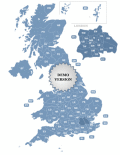
Postcode Map of UK 3.6
Postcode Map of UK. Features: - Color, URL linking, captions and more; - Intuitive Flash Map Interface; - Ease of Use; - Customizations via an XML file; www.fla-shop.com
free download trial (162 Kb)
|
|

|
US County Zoom Map 2.0
A cool-looking Flash map of the U.S. with all counties. This zoom map features high customization capabilities via a simple XML file. Texts, fonts, colors, popups messages and links are all adjustable.
free download trial (417 Kb)
|
|
|
|
|
|
MindOnMap for Mac 1.0.16
MindOnMap for Mac is inspired by the human brain's thinking patterns. It serves as a powerful tool for visualizing and organizing thought, and helps you to draw and collect your ideas in an effective and intuitive way.
free download trial (90.57 Mb)
|
|
|
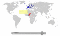
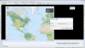
Pinpoint Locator Map of World 3.5
Pinpoint Locator Map of World for websites with wysiwyg editor tool. New release! Features: - Color, URL linking, captions and more; - Intuitive Flash Map Interface; - Ease of Use; - Customizations via an XML file
free download trial (528 Kb)
|
|

|
Automapki 1.5.1
Automapki application brings web mapping to AutoCAD / ZWCAD / BricsCAD to display your project on top of your favourite web mapping source: either Open Street Map, Map Quest, Open Aerial, or any user defined WMS base layer.
free download trial (32 Mb)
|
|
|
|
|
|
Automapki x64 1.5.1
Automapki application brings web mapping to AutoCAD / ZWCAD / BricsCAD to display your project on top of your favourite web mapping source: either Open Street Map, Map Quest, Open Aerial, or any user defined WMS base layer.
free download trial (32 Mb)
|
|
|
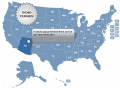
US and Counties Map Locator 1.0
United States and Counties Map Locator. The map contains locator maps of each state! Features: - Color, URL linking, captions and more; - Intuitive Flash Map Interface; - Ease of Use; - Customizations via an XML file; www.fla-shop.com
free download trial (750 Kb)
|
|

|
MLC Usa Map Puzzle 1
Solve this challenging USA Map Puzzle and have fun.
free download (341 Kb)
|
|

|
CoffeeCup Image Mapper 5.0
CoffeeCup Image Mapper allows you to specify multiple links (or hotspots) to specific locations of an image and point them to a document or website. Create mouseover text, ALT text, links and more. Supports JPG, PNG, and GIF image formats!
free download trial (3.37 Mb)
|
|
Pages : 1
| 2
| 3
| 4 | 5
|
|
|
|
