|
|
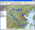
MPSuperShape 2.6
MPSuperShape is a shape manipulation tool for Microsoft MapPoint. MPSuperShape can combine shapes, find overlaps, find boundaries, and import/export various files. MapPoint 2006, .NET Framework 2.0 (or later), and Windows XP or Vista required.
free download trial (13.54 Mb)
|
|
|
Total GIS Converter 1.1
Total GIS Converter is a powerful converter on GIS files. It converts AEP, GRD, ADF, E00, FLT, APR, SHP, DXF, BT, TOC, RT1, DEM, DLG, ECW, IMG, DGF, GML, SID, MIF, TAB, WOR, DNG, DDF, BIL, JPEG, TTKPS, TTKLS, LFT, PFT, TFT to TIFF, PNG, JPEG, BMP.
free download trial (4.47 Mb)
:: order online ($99.90)
|
|

|
Advanced Points Manager 1.0
The Advanced points manager imports points to AutoCAD drawing from different data sources. OLE-DB Database, SHP (ESRI shape file), GPX (GPS eXchange format), KML (Keyhole Markup Language), GML (Geography Markup Language), TXT, CSV.
free download trial (609 Kb)
|
|
|
|
|

|
GrowCut 3.0
GrowCut is an interactive image cutout & matting tool designed to extract solid or opaque objects as well as objects having smooth or fuzzy edges. Image cutout is the process of removing or isolating an object in a picture.
free download trial (4.99 Mb)
|
|

|
Manco Shapefile Editor 2.0.0.0
Manco Shapefile Editor is a powerful tool for creating and editing shapefiles. Edit geometry of shapes easily. Add multiple images and enable an OpenStreetMap provider. Edit all the layers data at any time. Export your images to the shapefiles.
free download trial (5.33 Mb)
|
|
|
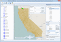
Manco Shapefile Editor 3.1.0.0
Manco Shapefile Editor is a powerful tool for creating and editing shapefiles. Edit geometry of shapes easily. Add multiple images and enable an OpenStreetMap provider. Edit all the layers data at any time. Export your images to the shapefiles.
free download trial (6.14 Mb)
:: order online ($100.00)
|
|
|
|
|

|
AvisMap Free Viewer 5.3.1
The free AvisMap Viewer opens most GIS/CAD and raster image file types and most ArcView, ArcExplorer, and MapInfo projects. Besides just opening and viewing files, the Viewer supports an extensive list of features.
free download (22.28 Mb)
|
|
Pages : 1
|
|
|
|
