|
|
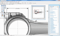
ACDSee Canvas 12 with GIS+ 12.00.1389
Canvas is the integrated application that accelerates your technical illustration workflow. Professionals in high tech environments that require accurate visualization of technical data rely on Canvas to collaborate and improve productivity.
free download trial (32 Mb)
|
|

|
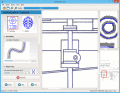
Map View SDK 1.2
The Map View SDK is available as a stand alone Developer kit. The Map View SDK offers a Direct DLL method to draw multi-type maps by region within your application.
free download trial (1.12 Mb)
:: order online ($999.95)
|
|
|
Vextractor Lite 1.00
Vextractor Lite is an auto-tracing program for converting raster images to vector formats. This tool could be used for the tracing of drawings, maps and line art images for input to CAD, GIS or Vector Graphics Design software.
free download trial (13.24 Mb)
|
|
|
|
|

|
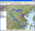
Graph Earth 0.9.5
Visualize your data in 3D! Quick, easy and inexpensive. Graph Earth enables business professionals to create stunning visual representations of their data, all without the time and costs associated with a full-feature GIS.
free download trial (469 Kb)
|
|
|
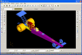
EWDraw 3D ActiveX 8.0
EWDraw3D ActiveX is a powerful vector graphics ActiveX for 3D and 2D visualisation and animation. You can use it for CAD,CAM,GIS and others. The EWDraw is based on Open CASCADE geometric kernel and openGL.
free download trial (17.01 Mb)
|
|

|
Aspose.Flash for .NET 2.9.0.0
Aspose.Flash is a non-graphical .NET Flash management component allowing developers to dynamically generate and edit Flash?® content directly from .NET applications. It provides complete support for Flash v8, Flash v9, Flash Lite and ActionScript.
free download trial (15.3 Mb)
|
|
|
|
|

|
E-XD++ Diagrammer Enterprise 15.01
E-XD++ Library for MFC by UCanCode.Net Software, an C++ class framework that provides your applications with a drawing surface for diagramming, symbol manipulation, drag and drop, scrolling, zooming, and many other graphics capabilities.
free download trial (19.07 Mb)
|
|

|
Algolab Raster to Vector Conversion Toolkit 2.97.68
Vectorizer for CAD/CAM/GIS professionals, designers and illustrators. Converts, digitizes and refines architect, mechan, tech drawing, maps, math graphs, graphics for books and journals. A Raster to Vector SDK, ActiveX and Com Component is available.
free download trial (1.66 Mb)
:: order online ($99.00)
|
|
|
MPSuperShape 2.6
MPSuperShape is a shape manipulation tool for Microsoft MapPoint. MPSuperShape can combine shapes, find overlaps, find boundaries, and import/export various files. MapPoint 2006, .NET Framework 2.0 (or later), and Windows XP or Vista required.
free download trial (13.54 Mb)
|
|

|
Icons-Land Vista Style POI Icon Set 1.0
Vista Style Points of Interest Icon Set can be used in Tourism and Entertainment industries, as it joins points of interest icons such as Restaurant, Bank, Hospital, etc. Being hand-crafted pixel by pixel all images are of capital quality.
free download trial (2.75 Mb)
|
|
Pages : 1
| 2 | 3
| 4
| 5
|
|
|
|
