|
|
TOPOWIN English 13.00
TOPOWIN is a state-wide register of the German topographic cartographies and of localities with geo references in different coordinate systems. It also is a topographic information system.
free download trial (3.42 Mb)
|
|
|
BetaDLL 2.01
BetaDLL contains precise functions for coordinate transformations and datum shifts using the German NTv2 standard BeTA2007. The Functions of the 32 bit / 64 bit DLL can be easy called from own applications.
free download trial (1020 Kb)
|
|

|
Woodstar FieldDiary 1.0
Electronic diary for storing of sightings and linked photos. You have templates for species, nest, sign and track and geographic objects such as locations, areas, routes and points. Also you can create your own templates for various data.
free download trial (3.3 Mb)
|
|
|
|
|
|
TRANSDAT (Deutsch) 13.42
TRANSDAT Coordinate Conversion supports thousands of coordinate systems and geodetic datum shifts, user-defined systems, INSPIRE, NTv2, BeTA2007, GPS, continental drift, many file systems, ESRI-Shape and much more with highest accuracy.
free download trial (3.58 Mb)
|
|

|
Horse Betting Selection Systems 1.0
Learn about various horse betting selection systems that may help beginners out with betting in this informative eBook. All the sections in the eBook are listed as follows: Introduction, Horse Betting Selection Systems and Recommended Resources.
free download (2.34 Mb)
|
|

|
Versamap 3 for Windows 3.01
Versamap draws outline maps on 16 map projections. Plot great and small circles. Print publication quality maps. Export maps in vector (WMF, CGM, DXF, ASCII) and bitmapped (BMP) formats. Add text to maps. Plot your own data in a simple ASCII format.
free download trial (3.98 Mb)
|
|
|
|
|

|
DRAGSENS 1.01
DRAGSENS Geo Software is used for the exact position estimation of a towed body, sensor, camera, array or net, dragged behind a ship, aircraft or vehicle. The software allows a real-time estimation of the position of a dragged sensor.
free download trial (1.76 Mb)
|
|

|
AvisMap Deskpro 5.1.0
AvisMap Desktop Professional 5 is a professional desktop GIS software for map editing, managing, analysis attribute data, aid decision-making transactions and output map, print tables, 3D modeling, and other functions.
free download trial (22.19 Mb)
|
|

|
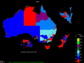
OzGISMac 14.7-14.11.2020
OzGISMac is an extensive system for the analysis and display of geographically referenced data. The system can be used to analyze socio-economic and demographic data produced by censuses and surveys and to support management decisions.
free download (307 Kb)
|
|
|
OzGIS 14.7.0.7
OzGIS is an extensive system for the analysis and display of geographically referenced data. The system can be used to analyze socio-economic and demographic data produced by censuses and surveys and to support management decisions.
free download (313 Kb)
|
|
Pages : 1
| 2 | 3
| 4
| 5
|
|
|
|
