|
|
|
|
|
|
|
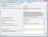
The program "Range: the development plan"
|
?????»????????: ?“???°???????‚???????‚?µ?»?????‹?? ???»?°?? 4.12.5
Author:
Supported languages: Russian
Supported OS: WinXP / WinVista / Win7 x32 / Win2000 / Win98 / WinME / Win95 / Windows 8
Price: Free
|
|
|
|
|
|
Poligon: the development plan" is a program to design the town-planning plan of land prepared in accordance with the requirements, approved by order of Ministry of regional development of the Russian Federation of 10 may 2011 N207.
The program "Range: the development plan is a standalone program for surveyors, land surveyors, cadastral engineers, architects with an intuitive user interface, simple and convenient, designed according to the wishes of experts, is used to create a development plan of land parcel.
In the program You can conveniently and quickly enter all the required data and coordinates import from various file formats to store information, to print both text and graphics section of the urban development plan (drawing) or in Microsoft Word (Microsoft Office) or the free office Writer (OpenOffice.org).
The graphics section of the development plan of land plot (drawing) is formed in the same document automatically on the existing coordinates using the approved symbols, line styles, colors.
Compliance standard:
The program is fully consistent with the order of Ministry of regional development of the Russian Federation N207 dated 10.05.2011 "On approval of the form of the urban development plan of land plot"
|

Free ?????»????????: ?“???°???????‚???????‚?µ?»?????‹?? ???»?°?? download - 5.36 Mbpgp_demo.exe
|
| Keywords:
Landfill, urban development plan, the land, the order of the Ministry of regional development of the Russian Federation N207 dated 10.05.2011 g, surveyors, land surveyors, cadastral engineers, architects |
|
|
|
|
|